 Ride CT & Ride New England Serving New England, NYC and The Hudson Valley!

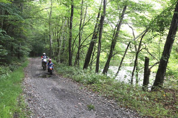
WATERBURY, CT – As expected, the recommended route for the Naugatuck Valley Greenway above the Thomaston Dam appropriates the roadbed of an abandoned portion of old Route 8 on the west side of Naugatuck River. It’s a route that will force off-road motorcycle riders – who have used the area since 1975 – to share with pedestrians and bicyclists.
In a long-awaited Draft Project Report issued Tuesday by the Naugatuck Valley Council of Governments, the planners selected a preferred route that bypasses the northern-most three miles of the trail riding area by going down the east side of the river along Valley Road to Wildcat Hill Road in Harwinton.
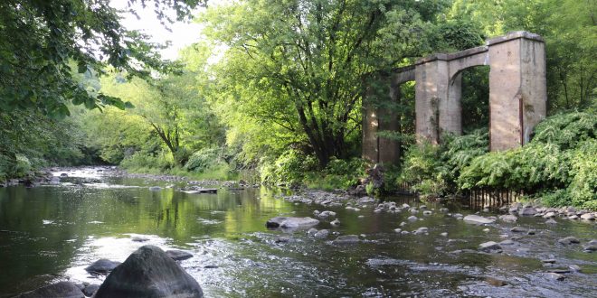
However, the greenway then proceeds south and jumps the river at Castle Bridge where a pedestrian bridge will be built using the remnant footings. It continues southward, splitting the riding area for two miles until it reaches Thomaston Dam, putting riders and everyone else in close proximity on land that is owned by the U.S. Army Corps of Engineers.
NETRA Disappointed
“I remain concerned and disappointed that the preferred route option bisects the only legal riding area in CT,” emailed Tony Gasper in reaction to the issuance of the report this afternoon. Gasper is president of the New England Trail Rider Association.
“NETRA strongly opposes any option that infringes on this precious area,” Gasper wrote. “On the other hand, if (and that’s still a big IF), the greenway comes to Thomaston Dam, the preferred route is the best option for our worst-case scenario.”
Roughly 40,000 riders use the riding area annually. As currently configured, the full trail system comprises a 13-mile loop, with northbound riders operating on the west side of the abandoned state roadway and southbound riders on the east side of the road immediately above the dam.
Route’s Rationale
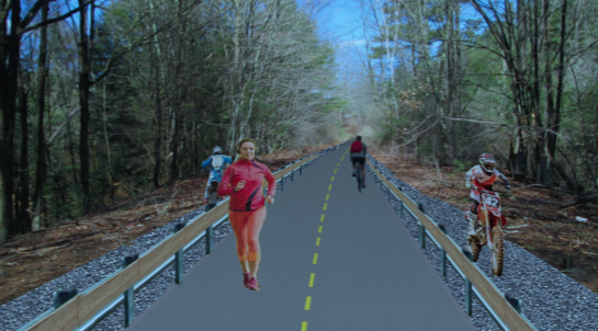
The report notes that “the Project Team worked with OHV representatives and the USACE to develop trail concepts for the safe separation of motorized and non-motorized users without negatively impacting OHV rider experience.
“The width of the paved roadway presents opportunities to physically separate motorized and non-motorized uses while preserving, or even improving, OHV flow. Where space is available on either side of the roadway, new vertically-separated OHV trails could be constructed parallel to the roadway to carry the OHV traffic currently using the paved roadway.”
Total cost of this section of the greenway is projected at more than $3.5 million. The cost of the greenway is expected to be funded by federal and state grants. The building and maintenance will be the responsibility of cities and towns along the 44-mile route from Torrington to Derby.
In the case of the greenway section above the Thomaston Dam, it will be USACE’s responsibility.
USACE Non-Committal
Steve Patchkofsky, project manager for USACE at the Thomaston Dam, said in response to the release of the route report that his agency “is still reviewing the draft. Many district offices will review this and then we will get together for a unified discussion.
“Several items will be looked at such as potential user conflicts, maintenance, security, permitting and obviously funding. At this time, we don’t have an official view as it’s too early in the draft stage,” he wrote in an email.
Public comments of the preferred route for the Naugatuck Valley Greenway will be taken through March 13.